EducationSoftwareStrategy.com
StrategyCommunity

Knowledge Base

Product

Community

Knowledge Base

TopicsBrowse ArticlesDeveloper Zone

Product

Download SoftwareProduct DocumentationSecurity Hub

Education

Tutorial VideosSolution GalleryEducation courses

Community

GuidelinesGrandmastersEvents
x_social-icon_white.svglinkedin_social-icon_white.svg
Strategy logoCommunity

© Strategy Inc. All Rights Reserved.

LegalTerms of UsePrivacy Policy
  1. Home
  2. Topics

KB221046: Why markers and areas cannot be displayed simultaneously on ESRI maps in MicroStrategy Web 9.4.1 Hotfix 6


Community Admin

• Strategy


Although both Show Markers and Show Areas have been enabled in ESRI Map Properties, the markers and areas cannot be displayed simultaneously in MicroStrategy Web 9.4.1 Hotfix 6.

SYMPTOM:
Although both Show Markers and Show Areas have been enabled in ESRI Map Properties, the markers and areas cannot be displayed simultaneously in Strategy Web 9.4.1 Hotfix 6.
STEPS TO REPRODUCE:

  • Insert ESRI map to a report services document.
  • Configure the ESRI map and enable both Show Markers and Show Areas.
  • Choose different attributes in the Select Location section and the Show Areas section.
ka04W000000OaT9QAK_0EM4400000025pq.jpeg
  • Execute the report services document and users can only get areas or markers on the ESRI map.
ka04W000000OaT9QAK_0EM4400000025ps.jpeg

CAUSE:
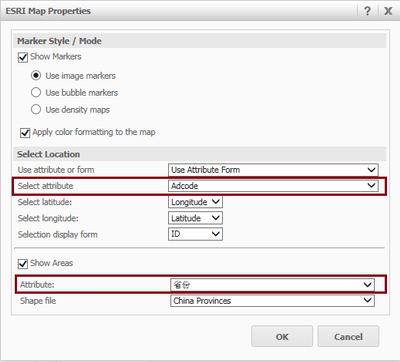
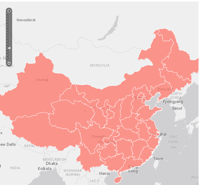
This is a known issue of Strategy Web 9.4.1 Hotfix 6. If different GEO attributes are selected in ESRI Map Properties, only markers or areas would be displayed when executing the ESRI map.
ACTION:
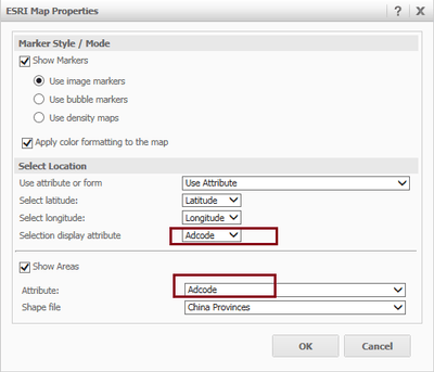
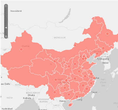
To display both markers and areas at the same time, users need to make sure the same GEO attribute has been selected for the Select Location and Show Areas sections in ESRI Map Properties.
If users import data, for instance from a local file, since it’s not supported to transform a column to an attribute form in Strategy Web 9.4.1, users need to make sure of the followings:

  • There the following three columns in the data source: an attribute with GEO role, the corresponding Longitude and Latitude.
  • When configuring the ESRI map,  Attribute is used instead of Attribute Form.
  • The form in ESRI Map Properties is filled out with the same GEO role attribute selected for “Selection display attribute” and “Attribute” as shown below:
ka04W000000OaT9QAK_0EM4400000025pn.jpeg

When the report services document is not executed, users can see both of the markers and areas displayed on the ESRI map:

ka04W000000OaT9QAK_0EM4400000025pw.jpeg


KB221046


Comment

0 comments

Details

Knowledge Article

Published:

April 13, 2017

Last Updated:

November 23, 2018