EducationSoftwareStrategy.com
StrategyCommunity

Knowledge Base

Product

Community

Knowledge Base

TopicsBrowse ArticlesDeveloper Zone

Product

Download SoftwareProduct DocumentationSecurity Hub

Education

Tutorial VideosSolution GalleryEducation courses

Community

GuidelinesGrandmastersEvents
x_social-icon_white.svglinkedin_social-icon_white.svg
Strategy logoCommunity

© Strategy Inc. All Rights Reserved.

LegalTerms of UsePrivacy Policy
  1. Home
  2. Topics

KB47677: ESRI map displays city markers in incorrect locations when the city name exists across multiple states in MicroStrategy Web 9.4.1 and above


Community Admin

• Strategy


This article details an issue with ESRI maps in which a city name exists across multiple states causing both points to be plotted.

SYMPTOM:
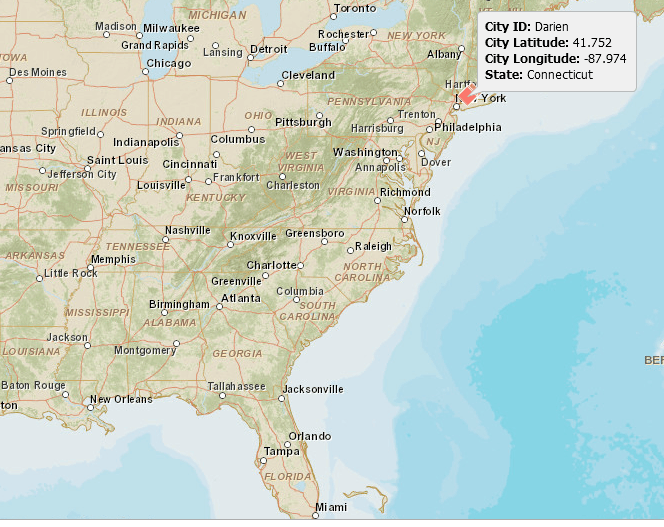
In Strategy Web 9.4.1 and above, users can quickly create an ESRI map by importing city names and their corresponding states names using Data Import and mapping the columns to the City and State Geo-roles, without the need for the latitude and longitude values beforehand. However, when the name of the city exists in multiple states, e.g. the city of Darien exists in the states of Illinois and Connecticut, although the state information is generated correctly, displayed in the tooltip for Connecticut, the city latitude and longitude are incorrectly generated for Illinois, plotting the marker in the wrong state, like shown below.
Note: In the example below, Darien, Illinois, was not part of the data imported.
ka04W000000OaaiQAC_0EM44000000264K.png

 
This issue occurs for ESRI maps in Report Services Documents, Visual Insight dashboards, Strategy Analytics Express, and Strategy Analytics Desktop.  
STEPS TO REPRODUCE:
  • Create an Excel file with City and State data.
  • Import the file into Strategy Web 9.4.1.
  • Map the City attribute to the City Geo-role.
  • Map the State attribute to the State Geo-role.
  • Select the Map visualization.
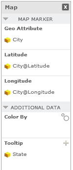
  • Place City in the Geo Attribute position. Latitude and Longitude values will be automatically populated.
  • Place State in the tooltip. The resulting configuration would look as below: 
ka04W000000OaaiQAC_0EM44000000264J.png

 
CAUSE:
This is a known issue in Strategy Web 9.4.1 and above. The city latitude and longitude is generated separately from the other columns in the excel file. When it finds a matching latitude and longitude for the city name, it moves on to the next row without verifying the data from other columns. 
ACTION:
Contact Strategy Technical Support for an update on the status of this issue.
WORKAROUND:
Provide the Latitude and Longitude information for each City to plot the markers in the correct places.
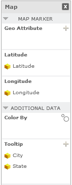
  • Create a file with City, Latitude, and Longitude columns.
  • Map each column to the proper Geo Role.
  • Place Latitude in the Latitude position.
  • Place Longitude in the Longitude position.
  • Place City in the tooltip.
ka04W000000OaaiQAC_0EM44000000264M.png

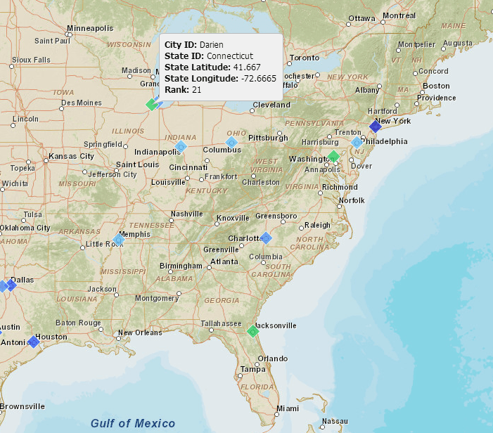
The marker displays correctly now:

ka04W000000OaaiQAC_0EM44000000264H.png


KB47677


Comment

0 comments

Details

Knowledge Article

Published:

May 17, 2017

Last Updated:

November 23, 2018