GIS Integration Help
Strategy's map integration solutions offers support for ESRI cloud-based Map, ESRI on-premises map and Google Maps that allow users to manipulate and analyze your mapped BI data.
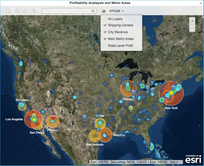

Strategy provides a free, cloud-based mapping solution that supports out-of-the-box GIS integration with the Strategy platform. GIS—geographic or geospatial information system—technology allows informed business decision-making because of its ability to capture, analyze, and present business intelligence data that is linked to location. Strategy's GIS integration lets business users visualize their data on maps so that they can identify and analyze relationships, patterns, and trends in their data.
Users can simply drag a "Geo-Attribute" into the geo-attribute field along with any metric to begin visualizing data. when placing a Data Import attribute into the Geo Attribute section of a map visualization, latitude and longitude data are automatically populated if the attribute is mapped to a geographical role.
Strategy Maps have the ability to be customized as well. users can create Custom Shapes for ESRI maps in Visual Insight or Report Services Documents for cloud-based ESRI map. Users can even change the markers to be customized images!
